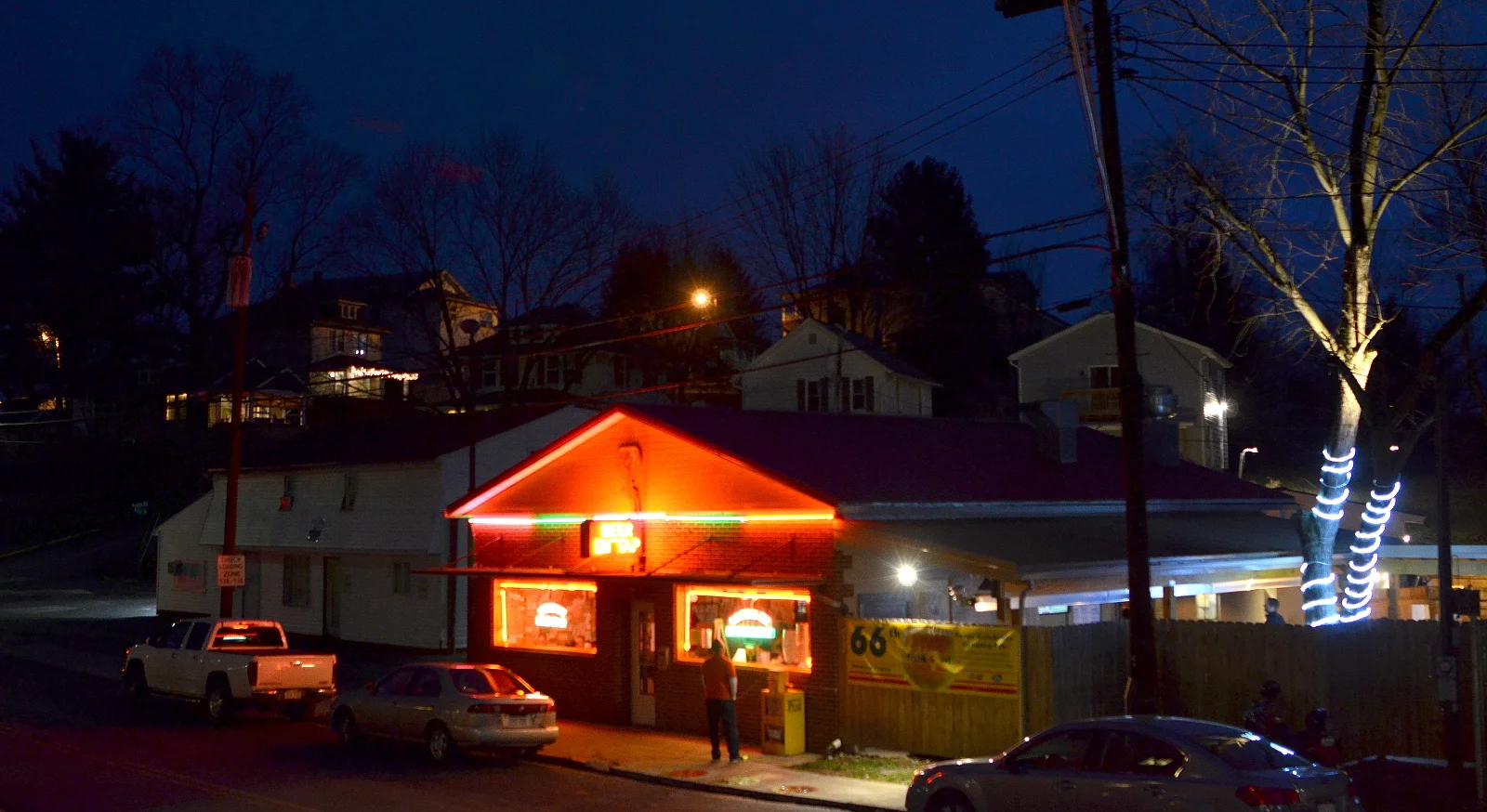
( The Feed )
The place is a #morgantown legend, and I'm glad to live within walking distance!


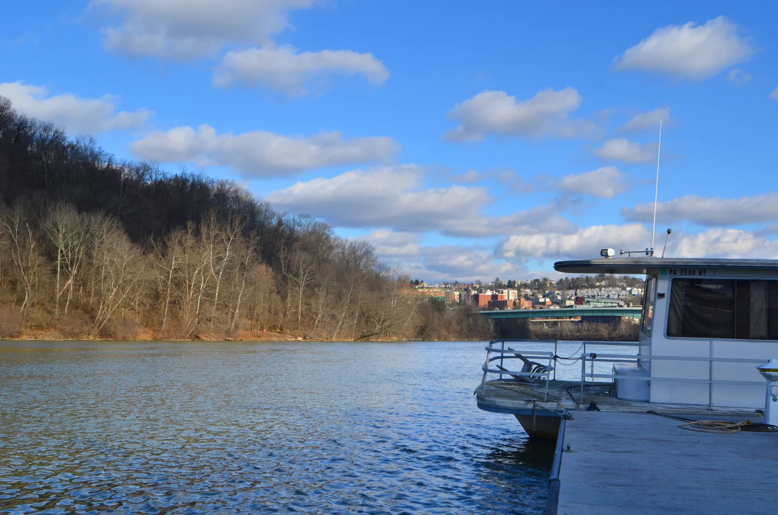
All about that #Morgantown life. Took these shots just before the snow.
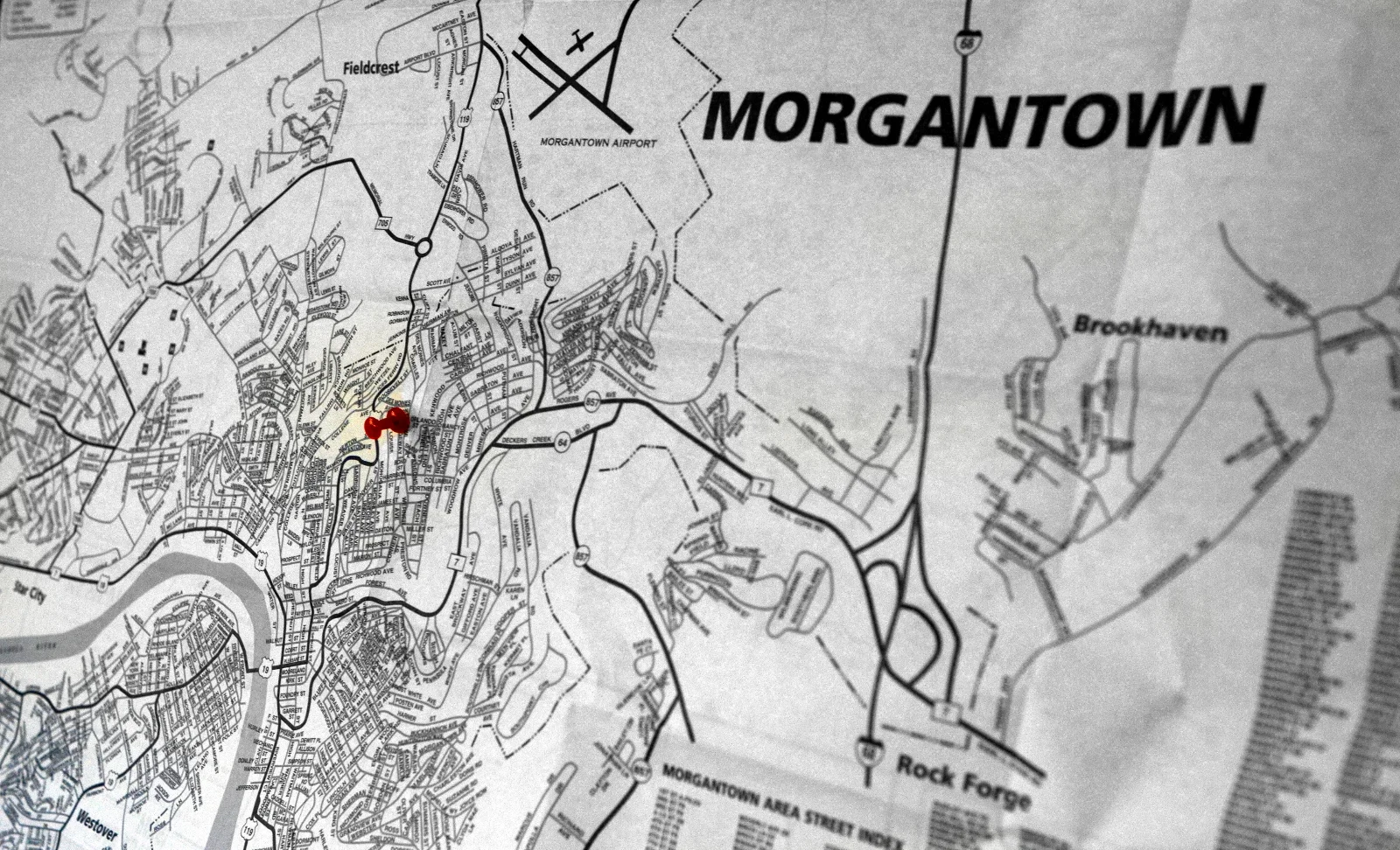
After driving more than 2,000 miles in three and a half days, I'm settled in Morgantown. First order of business: find a map.
No one uses maps any more. I know this because I drove around for 45 minutes looking for one. Four unproductive stops later, someone finally suggested that I go to the city's visitor center. The older, well-dressed lady who worked there had to go into the back to find me one. "Do you know how hard it is to find these?" she asked me. I assured her that I did, and we agreed that it was a shame.
Clearly, the decline of the availability of maps is due to the proliferation of GPS in smartphones. Here are some reasons I always like to have paper maps around:
1) Actually learning the territory
When drivers use GPS, they tend to focus almost entirely on a device itself. Follow the blue line and everything will be okay. Unfortunately, this leaves them mostly oblivious to the people, landscapes, businesses, socioeconomics, etc of the real world around them.
Maps, on the other hand, are there as a representation of the world, but require us to observe, anticipate and learn reality to be effective. If being an engaged citizen means to know the world we live in, maps are the clear preference. Maps naturally help people become independent and observant, while GPS reinforces a lack of awareness and dependency on itself.
2) Putting the world together
It is possible to drive two nearby roads (or to travel through two individual portions of a city) without ever really understanding how the they are connected or geographically related.
Maps provide a perspective of the interconnectedness of all places in a city, simultaneously. Where could someone stand in Granville and see across the Monongahela River into the Star City area? How to get there on gradual inclines rather than steep slopes? Maps!
3) Avoiding the infinite scroll
Why the hell would I look at a few square inches of a map at a time (on a smartphone) rather than see everything at once? While trying to mentally construct a map from a long scrolling session may be a good exercise in spatial reasoning, it's also a pain in the ass. Much more difficult than simply holding a map.
I'm not saying that my phone or GPS is going in the trash any time soon, but I love having paper on my wall, showing me the world as it is outside my door, down the street, along the river and into the county.

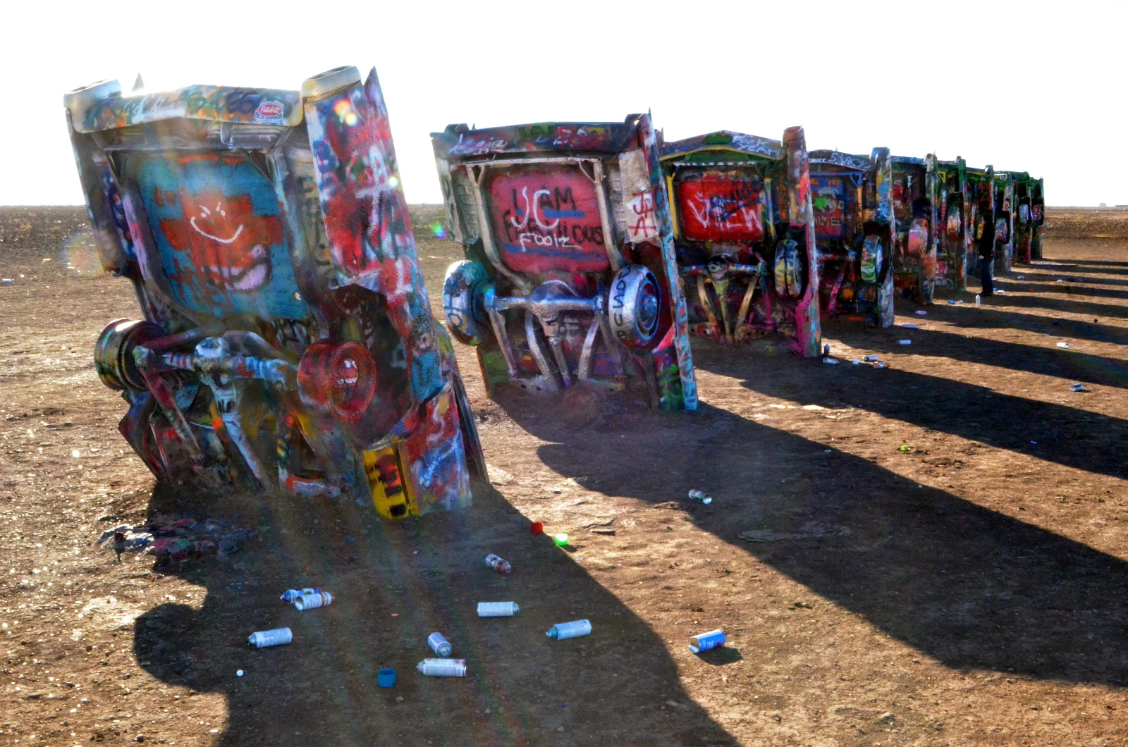
The Cadillac Ranch is... I'm not sure how to finish that sentence. It's a place in a Texas field outside of Amarillo where there are a number of Cadillacs half-buried in a row, like some linear, post-apocalyptic Stonehenge. Spray paint cans litter the ground. There is nothing else as far as you can see. Being there is surreal. I stopped by on my move from Richmond to Flagstaff (RVA-FAZ), spray painting my own little memory of why I was there.

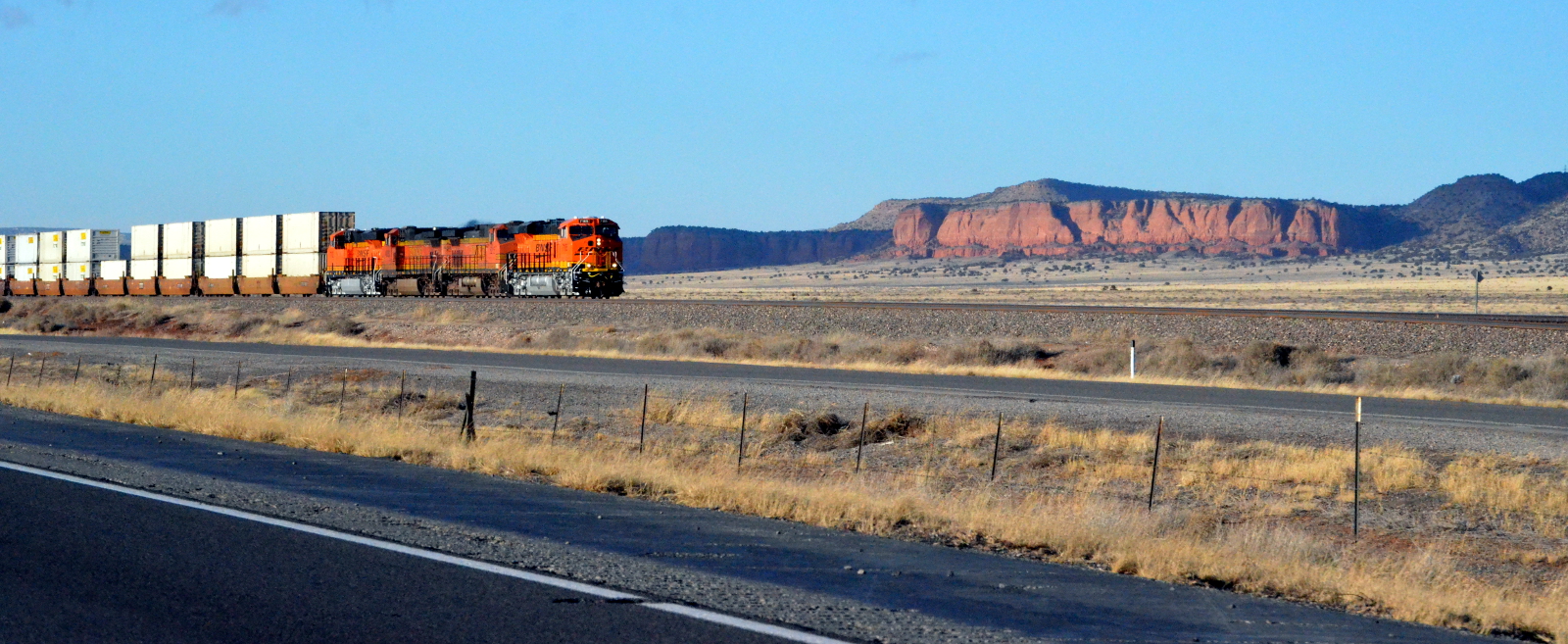
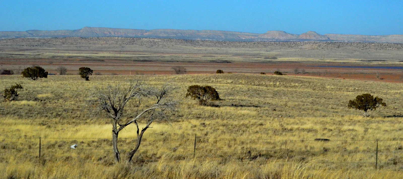
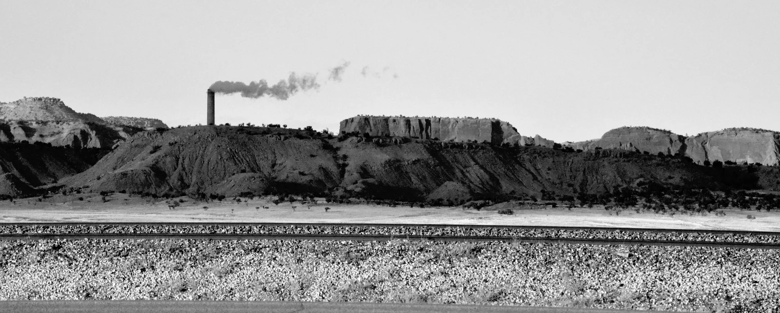
It is hard to capture the landscape of this place in photographs. It stretches forever, in all directions, and each cliffside only seems to make sense in the context of the others. There is a loneliness that stretches for hours, broken up by pockets of civilization. The Native communities are hidden from sight.
The trailers I see in the middle of desert and on the sides of rock outcroppings must be the loners, the rat race dropouts. I sympathize with them without desiring to join them.